Saturday, April 30, 2005
US volcanoes not watch appropriately
Dangerous volcanoes in six states are not adequately monitored, U.S. Geological Survey officials said Friday. The agency called for a new nationwide warning system.
Geologists conducted a new survey of the 169 known U.S. volcanoes and ranked them according to their threat to human life, property and aviation safety.
Alaska, California, Washington State, Oregon, Hawaii, Wyoming all have "dangerous volcanoes with monitoring gaps or no monitoring in place," the report concludes.
"We cannot afford to wait until a hazardous volcano begins to erupt before deploying a modern monitoring effort," said USGS Director Chip Groat. "The consequences put property and people at risk – including volcano scientists on site and pilots and passengers in the air."
Though volcanoes erupt sporadically, the risk is real.
"We nearly lost a fully loaded Boeing 747 to volcanic ash cloud in Alaska in 1989," said Capt. Ed Miller of the Air Line Pilots Association.
Miller said a partnership with the USGS now provides warnings that help pilots avoid such plumes. When Mount St. Helens woke up last October and spewed ash, the USGS Cascades Volcano Observatory notified air traffic control centers within five minutes.
By placing seismic instruments and other sensors on a volcanic mountain, geologists can detect early warning signs of possible eruptions and also note eruptions that are underway in remote locations. About half of the most threatening volcanoes are monitored at a basic level, the report found, while only a few are well watched.
"Monitoring capabilities at many hazardous volcanoes are sparse or antiquated, and some hazardous volcanoes have no ground-based monitoring whatsoever," the report states.
Eventually ...
The report calls for a National Volcano Early Warning System (NVEWS) that would create a 24/7 Volcano Watch Office.
"This is the only way to forewarn communities at risk in enough time to activate emergency response plans, and ultimately help save lives and property," Groat said.
Since 1980, there have been 45 eruptions at 33 volcanoes in the United States. Of those, 15 were considered notable, the report found.
The report found 13 "very high threat volcanoes" with inadequate monitoring. Though some erupt infrequently and may be dormant now, geologists expect them to eventually reawaken, and many are near large population center. The list:
Alaska: Redoubt, Makushin, Akutan, and AugustineCalifornia: Shasta, LassenOregon: Hood, South Sister, Crater Lake, Baker, NewberryWashington: Rainier, Glacier Peak
USGS officials and geologists plans to meet with federal agencies, state and county emergency management agencies, businesses and other organizations to finalize plans for the nationwide early warning system.
Volcanoes monitored in the USA
Reston, VA – The U.S. Geological Survey (USGS) today released the first ever comprehensive and systematic review of the 169 U.S. volcanoes and established a framework for a National Volcano Early Warning System (NVEWS) which calls for a 24-hour seven-day-a-week Volcano Watch Office and enhanced instrumentation and monitoring at targeted volcanoes.
The NVEWS report, which can be accessed online at http://pubs.usgs.gov/of/2005/1164/, ranks the most dangerous U.S. volcanoes that pose a threat to human lives, property, and aviation safety and also discusses monitoring gaps at each volcano. Alaska, California, Washington State, Oregon, Hawaii, Wyoming, and the Commonwealth of the Northern Marianas (CMNI) have dangerous volcanoes with monitoring gaps or no monitoring in place.
"We cannot afford to wait until a hazardous volcano begins to erupt before deploying a modern monitoring effort. The consequences put property and people at risk – including volcano scientists on site and pilots and passengers in the air," said USGS Director Chip Groat. "It forces citizens, scientists, civil and aviation authorities, and businesses into ‘playing catch up’ with a dangerous volcano, a risky game indeed.
To help keep communities safe, it is essential to monitor hazardous volcanoes so that we know when unrest begins. This is the only way to forewarn communities at risk in enough time to activate emergency response plans, and ultimately help save lives and property." According to the USGS report, since 1980, 45 eruptions and 15 cases of notable volcanic unrest have occurred at 33 U.S. volcanoes. About half of the most threatening U.S. volcanoes are monitored at a basic level and a few are well monitored with a suite of modern instruments.
However, the report cautions, monitoring capabilities at many hazardous volcanoes are sparse or antiquated, and some hazardous volcanoes have no ground-based monitoring whatsoever. This poses a threat to people on the ground and in the air. Flying into an ash cloud can cripple a jet aircraft in flight. Tens of thousands of people fly over U.S. volcanic regions every day.
Based on the NVEWS analysis and volcanic activity as of April 2005, the three highest priority targets for volcano monitoring improvements are: The volcanoes erupting now – Mount St. Helens in Washington State, Anatahan in the Mariana Islands, and Kilauea in Hawaii – and the volcanoes that are showing periods of significant unrest – Mauna Loa in Hawaii and Mount Spurr in Alaska;The 13 very high threat volcanoes with inadequate monitoring: nine volcanoes in the Cascade Range of the Western United States: Rainier, Hood, Shasta, South Sister, Lassen, Crater Lake, Baker, Glacier Peak, and Newberry.
Although Cascade volcanoes do not erupt frequently, they threaten major populations and developments. Four Alaskan volcanoes in this group include: Redoubt, Makushin, Akutan, and Augustine;Nineteen volcanoes in Alaska and the Mariana Islands that pose high risks to aviation combined with no real-time ground-based monitoring to detect precursory unrest or the onset of an eruption. An additional 21 under-monitored volcanoes in Washington, Oregon, California, Hawaii, Alaska, the CNMI, and Wyoming are also priority NVEWS targets.Globally, institutions with the responsibility to monitor volcanic hazards and mitigate impacts face growing demand for rapid hazard analysis and real-time eruption reporting.
This demand is exemplified by the aviation sector’s stated need that air traffic control centers be notified by a volcano observatory of an ash-producing eruption within five minutes of the start of the eruptive event. This ambitious goal was met by the USGS Cascades Volcano Observatory when Mount St. Helens reawakened in October 2004."We nearly lost a fully loaded Boeing 747 to volcanic ash cloud in Alaska in 1989," said Capt. Ed Miller of the Air Line Pilots Association. "Thanks to our USGS partnership, alerts and procedures now exist that help pilots avoid and respond to this extremely serious aviation hazard.
"In contrast, the lack of monitoring has serious consequences. For example, at Anatahan volcano in the Mariana Islands, no real-time monitoring capability existed when the volcano unexpectedly erupted in 2003, and a distressingly long period of several hours elapsed before the eruption could be confirmed using images from satellites.Volcano monitoring in the United States is conducted by five volcano observatories supported primarily by the USGS Volcano Hazards program. They are the Hawaiian Volcano Observatory, the USGS Cascades Volcano Observatory, the Alaska Volcano Observatory, the Long Valley Observatory, and the Yellowstone Volcano Observatory.
Under the federal Stafford Act, the USGS is responsible for issuing timely warnings of potential volcanic disasters to the affected populations and to civil authorities. The volcano observatories issue notices and warnings of conditions at monitored U.S. volcanoes on a regular basis or as often as warranted during eruptive episodes. The USGS operates the observatories with the help of universities and other government agencies through formal partnerships.
As a follow-up to releasing the NVEWS report, the USGS Volcano Hazards Program will convene workshops with key stakeholders including federal agencies, state and county emergency management agencies, the Consortium of U.S. Volcano Observatories, businesses, and private organizations to review and refine the NVEWS framework. The report was authored by USGS scientists and volcano experts: John W. Ewert, Marianne Guffanti, and Thomas L. Murray.
Super volcano eruptions
Last week, several Hawaii Volcano Observatory scientists were accompanied to Pu`u `O`o by a film crew producing a NOVA program for PBS. The producer was interested in the research we're doing on an active volcano, but the main focus of the program is an eruption that happened long ago and far away — about 74,000 years ago on the island of Sumatra. The eruption of Toba Volcano was the largest eruption in the last two million years, and, according to some theories, almost wiped out our human ancestors.
The scale of the Toba eruption is difficult to comprehend. Pyroclastic flows (hot flows of ash and pumice) covered an area of at least 20,000 square kilometers (7,700 sq mi), with deposits as thick as 600 m (2,000 ft) near the vents. Ash fall was widespread over much of southeast Asia. An ash layer approximately 15 cm (6 in) thick was deposited over the entire Indian subcontinent. Our appreciation of the magnitude of this eruption continues to grow as Toba ash is recognized farther and farther from the source.
The volume of the Toba eruption is estimated at 2,800 cubic kilometers (670 cu mi). To give some comparison with more recent eruptions, the 1980 eruption of Mount St. Helens produced less than 1 cubic kilometer (0.25 cu mi). Vesuvius (A.D. 79) erupted about 5 cubic kilometers (1.2 cu mi), and Krakatoa in Indonesia (1883) about 12 cubic kilometers (3 cu mi). Closer to home, the volume of Kilauea's ongoing eruption is about 2.6 cubic kilometers (0.6 cu mi), erupted over the last 22 years. The most widespread hazard from such an eruption is its effect on global climate.
Large, explosive eruptions eject huge amounts of volcanic ash and gas that reach the stratosphere. Sulfur dioxide gas reacts with atmospheric moisture to form tiny droplets of sulfuric acid. The droplets and ash particles both absorb heat and reflect solar radiation, cooling the lower atmosphere. While ash tends to settle out of the stratosphere within months, the aerosol of sulfuric acid can remain in the stratosphere for 2-3 years before dissipating. We have no direct knowledge of the length or severity of global cooling caused by the Toba eruption.
Some scientists, however, have speculated that a severe "volcanic winter" triggered by the eruption, combined with the effects of ash fallout, may have brought about the near extinction of early humans in the path of the Toba fallout. You can still see the remains of this eruption on Sumatra, where beautiful Lake Toba fills the caldera formed when the magma chamber emptied.
The area has been rattled by several major earthquakes in the last century, but there have been no eruptions at Toba in historical time. In light of recent events, it may seem that Sumatra is particularly prone to natural disasters. In fact, so-called "super eruptions" have occurred in many parts of the earth, including several in the western United States. The largest known explosive eruption in the world originated from the La Garita caldera in the San Juan Mountains of Colorado approximately 28 million years ago.
The ash-flow deposit from this eruption, known as the Fish Canyon Tuff (tuff is consolidated ash), has an estimated volume of 5,000 cubic kilometers (1,200 cu mi). At Yellowstone (featured in "Volcano Watch" and a television special a few weeks ago), the largest eruption produced a volume of ash only slightly less than that of Toba about 2 million years ago. As noted in our earlier column, the odds of such an event occurring in our lifetime are vanishingly small, but that needn't lessen our desire to learn more about these amazing eruptions. Activity Update Eruptive activity at Pu`u `O`o continues. Glow is visible from several vents within the crater on clear nights.
The PKK lava tube continues to produce intermittent surface flows from above the top of Pulama pali to the ocean. Surface flows are active on the coastal plain inland of East Lae`apuki and Kamoamoa, within 30 m (100 ft) of the sea cliff. Lava has been entering the ocean at East Lae`apuki since April 25. This is the closest activity to the end of Chain of Craters Road, in Hawai`i Volcanoes National Park, and is located about 4.7 km (3 miles) from the ranger shed. Expect a 2-hour walk each way and bring lots of water.
Stay well back from the sea cliff, regardless of whether there is an active ocean entry or not. Heed the National Park warning signs. During the week ending April 28, two offshore earthquakes were felt on Hawai`i Island. A magnitude-4.2 quake occurred 52 km (32 miles) southeast of Na`alehu (beyond Lo`ihi) at a depth of 9 km (6 miles) at 3:01 a.m. on Saturday, April 23; this earthquake was felt at various places on the island.
A magnitude-3.4 quake occurred 65 km (40 miles) northwest of Kailua at a depth of 13 km (8 miles) at 8:13 a.m. on Tuesday, April 26; it was felt at Kailua and Waimea. Mauna Loa is not erupting. During the week ending April 20, 6 earthquakes were recorded beneath the summit area. Four were deep and long-period in nature. Inflation has slowed beneath the summit over the last few weeks.
Remembering the volcanologist, Dr. Raymundo Punongbayan
CITY OF SAN FERNANDO-Like Mt. Pinatubo, the volcano that he said brought out the best and the worst in him, Dr. Raymundo Punongbayan is at rest now.
Death came in a violent way, through a helicopter crash on Mt. Namal in Gabaldon, Nueva Ecija, on Thursday morning.
Punongbayan, the former chief of the Philippine Institute of Volcanology and Seismology, was scheduled to assess geological hazards in Barangay Paltic in Dingalan, Aurora when the accident occurred.
Punongbayan-Ray to his friends and enemies, RSP to his colleagues and students-was best remembered as the scientist who helped lead Central Luzon out of the disaster caused by Mt. Pinatubo's eruptions in June 1991.
During the 10th year of the disaster in 2001, the Aetas of Zambales and Religious of the Virgin Mary nuns credited Punongbayan for listening to people and trusting them.
Then the director of the poorly funded and understaffed Phivolcs, Punongbayan sent a team to Zambales to confirm reports of steams and frequent earthquakes on the western flanks of Mt. Pinatubo two months before the eruptions.
In casual conversations several years after, Punongbayan said the major challenge that he faced was how to make people believe that a volcano was in its eruptive stage.
There was disbelief because nobody knew, not even the elders of the Aetas, that Pinatubo was a volcano. Nobody, too, has an experience with eruptions. To the tribe, it was a mountain where a powerful deity, Apo Namalyari, lived. Punongbayan advised evacuation in phases.
As the magma built up and rose to the crater, he relieved his tension by smoking, and smoking a lot.
In stages, the Phivolcs expanded the danger zone from 10 to 40 km. Outside that huge zone was a population of four million people in Pampanga on the east, Tarlac on the north and Zambales on the west. They had no idea they lived under the shadow of an angry volcano.
The large population at risk made the task even more daunting, he said.
As he dished out advisory after advisory, he said he left it to the National Disaster Coordinating Center to bring the information to the local governments and the communities.
What irked him then, he said, was the slow relay of information to the villages.
Patience was not his best trait and he thought it was wise that the work was left to Jean Tayag, his information and education chief at Phivolcs.
Punongbayan knew the power of media in information sharing. The problem was, some reporters did not understand the language of volcanology, much less spell out correctly his agency's name.
From the start, he said he realized the need to speak in layman's terms. He simplified these also for reporters. He still encountered the problems of misreporting or inaccurate reporting.
Explaining lahar to officials and reporters was one of his tasks. Teasing the Kapampangans who often miss on their "h," he pronounced lahar as "la-ar."
With the big role he played in disaster management, Punongbayan became a sort of soothsayer and at the same time a calming, reassuring figure.
Punongbayan was not only a scientist; he, too, was a technocrat.
As the disaster drew out the best in Phivolcs, it also revealed how poorly equipped it was. It was during Punongbayan's stint, until he retired in 2003, that the agency got grants for new seismic stations, a new building, and more research and study grants.
He always lamented how funds were lacking for his agency that monitored 30 volcanoes and earthquakes in the country.
The "Man of the Year" award that the Inquirer bestowed on him elated him, he said. That was because he said he "only did what I needed to do."
Standing at 5 foot 2 inches and simple in bearing, Punongbayan looked like the common man. He could be lost in the crowd but he got so popular that in forums, his audience would clap wildly when they recognize him.
He retired at 65, but that didn’t mean he stopped working. He took in consultancy jobs for local governments that were conscious of potential threats in their midst.
Before the landslides occurred in eastern Luzon in November and December 2004, Punongbayan was doing research in the area on his own funds.
And so while everybody blamed illegal logging for the many deaths, he gave a loud dissenting opinion, saying that what occurred in the area were flashfloods.
Water from strong rains dammed at the summit and gushed to wash out everything in its path, he said. He gave this assessment after flying over Quezon and Aurora provinces that December.
This correspondent met Punongbayan hours after that flight. In between puffs of cigarette, he said: "The mountain's scarred."
The flight, he added, tired him. "I like flying over mountains, seeing the trees down. The mountain's scarred like Pinatubo was then. Go rush with your story. Flashfloods are what communities should learn to watch out for," he said.
US should watch all volcanoes not only some
WASHINGTON Apr 29, 2005 — While Mount St. Helens and Kilauea generate the most attention, many other volcanoes in the United States have little or no regular monitoring and need to be watched for potential eruptions, a new report warns.
The U.S. Geological Survey said Friday that monitoring gaps exist for volcanoes in Alaska, California, Washington, Oregon, Hawaii, Wyoming and the Northern Mariana Islands that could pose a hazard both on the ground and to aviation.
The report reviews the hazard of 169 volcanoes in the U.S. and its territories and calls for a 24-hour, seven-day Volcano Watch Office and increased monitoring at many of the peaks.
"We cannot afford to wait until a hazardous volcano begins to erupt before deploying a modern monitoring effort. The consequences put property and people at risk including volcano scientists on site and pilots and passengers in the air," said Survey Director Chip Groat.
"It forces citizens, scientists, civil and aviation authorities, and businesses into playing catch up with a dangerous volcano, a risky game indeed," he said.
Monitoring volcanoes in advance of problems is essential to help develop emergency response plans to keep communities safe, he said.
The study said three groups of volcanoes are the highest priority for study:
The volcanoes erupting now Mount St. Helens in Washington State, Anatahan in the Mariana Islands, Kilauea in Hawaii and the volcanoes that are showing periods of significant unrest, Mauna Loa in Hawaii and Mount Spurr in Alaska.
The 13 very high threat volcanoes with inadequate monitoring. These include nine volcanoes in the Cascade Range Rainier, Hood, Shasta, South Sister, Lassen, Crater Lake, Baker, Glacier Peak and Newberry. Also, four Alaskan volcanoes, Redoubt, Makushin, Akutan and Augustine. The agency noted that while Cascade volcanoes do not erupt frequently, they threaten major populations and developments.
Nineteen volcanoes in Alaska and the Mariana Islands that pose high risks to aviation combined with no real-time ground-based monitoring to detect precursory unrest or the onset of an eruption.
Friday, April 29, 2005
He lived fully his passion for volcanoes
The man who was catapulted to fame after predicting one of the world’s biggest volcanic eruptions in the last century — that of Mt. Pinatubo on June 12 to 15, 1991 — is gone. Dr. Raymundo Punongbayan, former director of the Philippine Institute of Volcanology and Seismology (Phivolcs), died in a helicopter crash yesterday morning in Barangay Ligaya, Gabaldon, Nueva Ecija.
The crash also claimed the lives of Phivolcs personnel Jessie Daligdig, Norman Tungol, Dindo Javier and Orlando Abengonza. Punongbayan, accompanied by the Phivolcs personnel, was on his way "to assess the various natural hazards in the area of Dingalan, Aurora and Gabaldon, Nueva Ecija, in relation to the selection of a safe site for rehabilitation and resettlement of affected communities during the 2004 typhoons" when the Huey helicopter crashed into a mountainside.
"He died for his country. He died performing the passion of his life – mitigating disasters," Lulu Punongbayan-Jaleco, the eldest of his four children, told The STAR yesterday. According to Sen. Richard Gordon, Punongbayan had sent him an email on the eve of the fatal crash, outlining his mission to Dingalan and showing the former Phivolcs director was dedicated to his work up until the end. A pall of gloom settled over Phivolcs offices yesterday upon news of the fatal crash.
The rest of the Punongbayan children — Stauro, Eric, and Andaluz and granddaughter Bea — are still shocked by his death and could only say how proud they were of "Daddy." Punongbayan, or "RSP" as he was fondly known to associates and friends, including those in the media, was born in Tondo, Manila. He finished high school at Torres High School in Gagalangin,Tondo. He was a licensed geologist, having graduated in 1960 with a Bachelor of Science degree in geology from the University of the Philippines in Diliman. He later obtained his Ph.D in Geology from the University of Colorado in 1972. He was appointed director of Phivolcs in 1982.
Punongbayan was instrumental in making the concepts of volcanoes and earthquakes understandable to laymen thorough his clear explanations of technical terms. This he accomplished with the help of the many reporters he urged to undergo seminars and hands-on education on geologic and other natural hazards in the country, including volcanoes and the so-called earthquake generators. He also enjoined the Phivolcs volcanologists and seismologists, through government scholarships and other institutional grants, to further their studies and enhance expertise in their respective fields.
Through his efforts, Phivolcs produced educational materials on volcano monitoring, earthquake and natural hazards mitigation, and organized seminars and conferences that brought together local and international experts in the fields of volcanology, seismology and natural hazards mitigation. "He was very passionate about his work," Lulu told The STAR, recalling that her father was a "virtual resident" of his Phivolcs office, first in Hizon Building along Quezon Avenue, then in the Phivolcs Building at the UP-Diliman campus until his retirement at age 65 in 2003.
Lulu said her father could have gone somewhere else after his retirement, perhaps to become a consultant for the US or Japan. "But he chose to stay here as he wanted to do some more for the country," she said. As Phivolcs director, Punongbayan helped put the institute on the international map of volcanology and seismology after successfully predicting Mt. Pinatubo’s eruption in 1991. Awards, citations and accolades for both his scientific and management expertise came and continue to come due to Phivolcs’ continuing exemplary performance. The most significant awards he got were the 2001 national disaster Coordinating Council Special Citation Award, the NCRP Achievement Award for Earth Science in 1999, the 1998 Dioscoro L.
Umali Medal for Outstanding Science Administrator Award, Outstanding Professional in Geology granted by the Professional Regulation Commission in 1997, the 1996 Model Public Servant of the year and the 1996 Lingkod Bayan Presidential Awards. "He is the only Asian to have received the Sergei Solviev Medal in 2002 for his exceptional research and skills in mitigating natural hazards which led to the saving of thousands of lives during the Mt. Pinatubo eruption in 1992," his daughter Lulu added.
"Daddy died a poor man," she said, disclosing that they still live in the same apartment they have been renting for years now. "But he left us with the ‘wealth of his name’ and the principles he has always lived for and his passion for his work," Lulu told The STAR.
Volcanologist passed away but he is remembered
"THE HEAVENS fell" is an apt description of what people saw in the sky when Mount Pinatubo erupted. That media event rearranged the course of history and the meaning of life in the minds of statesmen and politicians, the moralists and the superstitious, poets and scientists, businessmen and believers, and the man in the street.
One person who refused to be intimidated by such apocalyptics was Raymundo S. Punongbayan, director of the Philippine Institute of Volcanology and Seismology.
With his calm voice and warm paternal face wearing a twitch of a smile, he virtually took the helm of government and directed the nation out of chaos and ignorance in those days of massive mudflow, sulfur, pyroclastics and lahar.
last April when the volcano started acting up to the monsoon months, when lahar was sweeping over the Central Plains, Punongbayan was a byword on the lips of a terrified people.
Most credible
Punongbayan was a most credible man because he was "ordinary." A geology major, married to a nurse, and father of four, he taught at the University of the Philippines before he joined Phivolcs in 1982 when the institute was just an obscure department at the Manila weather bureau.
His name was first heard during the earthquake that devastated Luzon in July 1990.
Punongbayan is aware that the country's resources hardly provide for its tectonic setting.
Though one of the world's most earthquake-prone countries with an average of five quakes a day, the Philippines lacks seismic stations, monitoring equipment and trained personnel. Only one of our 12 seismic stations has a telephone. First reports of earthquakes here come from monitoring services in Hong Kong or the United States.
In 1987, Punongbayan first raised his voice to call on government for disaster preparedness. No one listened, until the killer quake struck in 1990 and hundreds of lives were lost.
Sleepless in land of volcanoes
In early 1991, his voice was again heard warning of volcanic eruptions. This time everybody listened, and so thousands of lives were saved.
Punongbayan is one of the few men sitting in vigil over the nation day and night. There is no holiday for him because all the days look the same.
"You can't take long naps because volcanoes don't sleep," he once said in an interview.
"My kids are excited about my job, but my wife is not," he said, looking forward to a time when he can stay home and cook for his family, maybe write poems as he used to, or do some sketches, without bothering about earthquake-and-volcano updates.
Unlike typhoons, the occurrence of earthquakes and volcanic eruptions can never be predicted by even the most modern technology. Aside from keeping a 24-hour watch on dangerous mountains such as Pinatubo, Taal, Mayon, Kanlaon, Hibok-Hibok and Bulusan, Punongbayan has to soothe the people's panic or even their anger at the bad news he brings, such as his recent revelation about the Marikina Fault.
But how can one watch over a land with 200 volcanoes, 21 of them active, and still get some sleep?
Making do with primitive tools, a man with the level-headedness of Punongbayan faced Pinatubo as it spewed an apocalyptic amount of energy.
Grateful nation
The nation is grateful for that calm, analytical mind that confronted the fury of a mountain that has reshaped geography and the lives of millions.
The nation is grateful to Punongbayan and his comforting presence that forged ahead, like Moses leading his people out of the plagues, in the time of terror and devotion.
The Ambrym volcano is partly responsible for Vanuatu's nickname

The Ambrym volcano is showing its temper which is why it should be taken seriously, especially since the beginning of some activity about a year ago.

The Ambrym volcano is one of the reasons that Vanuatu has the nickname: "Land of fire". Over the last year, its activity has been increasing regularly. An Australian vulcanologist is warning people that because of that, it should not be underestimated. After all, its last eruption in 1905 was one of the worst volcanic eruption in 400 years.
Vulcanologist warns people to take the Ambrym volcano seriously
An Australian vulcanologist has warned that a volcano on the Vanuatu island of Ambrym could have a major impact on local communities if it erupts again. The eruption of Ambrym in 1913 was one of the largest in Melanesia in 400 years.Vulcanologist John Seach says a new eruption of Ambrym would be unlikely to affect Vanuatu's main island of Efate.But he says it could cause major destruction, and has the potential to take lives."Ambrym has a history of quite destructive eruptions, so potentially it is a very serious volcano and the level of activity over the past year needs to be taken seriously. A particular volcano has a pattern that is often peculiar to itself. So what it has done in the past it is capable of doing in the future."
Small magma chamber might create trouble
A group of international researchers plans to use studies by land and by sea to determine the size and shape of an underground magma chamber beneath an active volcano, which will help improve the ability to assess hazards and forecast volcanic events.
“We can look at changes on the surface and infer what is happening at depth, but we don’t know the physical dimensions,” said Glen Mattioli, professor of geosciences at the University of Arkansas.
Mattioli and colleagues from Penn State University, Duke University, Cornell University, the Carnegie Institution in Washington, D.C., and from England, have extensively studied the Soufriere Hills Volcano on the island of Montserrat in the Caribbean, which has been erupting sporadically since 1995. To date, they have focused their attention on the processes occurring beneath the earth’s surface both before and during eruption episodes – building knowledge that may help build better forecast models for areas with active volcanoes.
Based on years of data, the researchers believe they have detected a magma chamber that lies beneath the volcano. Determining the size and contents of the magma chamber would go a long way toward helping researchers determine the future behavior of the volcano. A small magma chamber, for instance, may produce shorter or fewer eruptions than a large magma chamber.
The researchers have obtained funding from the National Science Foundation (NSF) and the Natural Environmental Research Council to coordinate sensors already in place on the island with sensors used at sea to create an image of the magma chamber, estimated to be more than five kilometers beneath the surface. The project builds on the NSF-supported CALIPSO (Caribbean Andesitic Lava Island Precision Seismo-geodetic Observatory) project, which funded the installation of four high-sensitivity borehole seismic stations around the Soufriere Hills Volcano to measure ground deformation with strainmeters, tiltmeters, and cGPS. The stations enable researchers to take detailed measurements of volcanic activity.
The new experiment, dubbed SEA-CALIPSO (for Seismic Experiment with Air-gun source) will use air guns and a string of sensors off the back of a research ship combined with sensors on land to try to image the magma chamber. The air guns will create seismic waves that will reverberate through the earth. As the seismic waves propagate, a certain percentage of the energy created is reflected and can be measured by the sensors. The direction of that energy is related to the properties of the material the waves pass through, and based on the direction, scientists can determine if the material is gas, liquid or a combination of liquids and solids. The researchers also can use the speed of the waves to determine information about temperatures, which can help pinpoint whether or not the material in the magma chamber is liquid, solid, gas or a combination of the three. The researchers map the speed and direction of the various waves to get an image of the shape and contents of any underground chambers.
The experiment will require a large number of sensors in a small amount of space. “We’re looking for something that’s pretty small,” Mattioli said. Estimates of the size of the magma chamber are between one kilometer to tens of kilometers in diameter.
The prolonged eruption on Montserrat, which began in 1995, drove away more than half of the island's 11,000 inhabitants, killed the tourism industry and buried the airport in a pyroclastic flow. The island has become a living observatory for researchers who want to learn more about active volcanoes. They work closely with researchers at the Montserrat Volcano Observatory to help improve their ability to assess hazards and forecast events for the benefit of public safety.
Wednesday, April 27, 2005
View of a more peaceful time for Mount Karthala
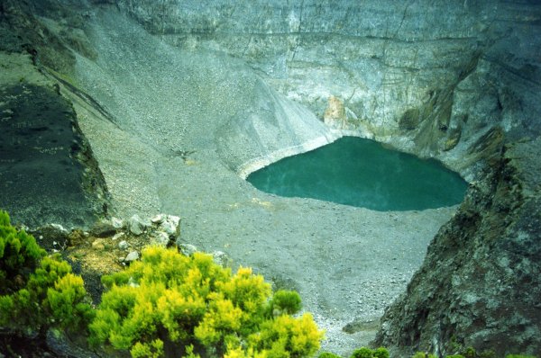
Mount Karthala's eruption ended after a week of volcanic activity.
Volcanic eruption of Mount Karthala has ended
MORONI, April 23 (AFP) - The week-long eruption of Mount Karthala on the main island in the Indian Ocean Comoros archipelago, is over, experts said Saturday, but they did not rule out the possibility of further eruptions.
"The eruption of April 16 is over," Hamidou Nassor, a vulcanologist from the French Indian Ocean island of Reunion, told a press conference in Moroni. But "we do not totally exclude the possibility of an eruption in the coming weeks, months or year."
He recommended maintaining for several more days the alert warning currently in place on the island of Grand Comore.
Following the eruption which started last weekend, hundreds of villagers at the foot of the 2,361-meter (7,746-foot) volcano fled their homes for fear of molten lava -- although none actually flowed outside the crater.
The volcano's last magma eruption was in 1977, when molten lava destroyed the village of Singani, some 20 kilometres (12 miles) south of Moroni and toxic gas was released into the air but caused no deaths.
Volcano eruptions and war are part of village's history
Eruptions and wartime relics only add appeal to resilient Rabaul, Lloyd Jones writes.
A giant volcano pumping plumes of ash high into the air might sound like something to avoid.
But for visitors to Rabaul in Papua New Guinea, the steaming hulk of Mount Tavurvur provides a dramatic backdrop to their exploration of this resilient volcano town and the surrounding region.
The tropical port, more than 100 years old, has been shaken and scarred by devastating volcanic eruptions and war, but keeps rising from the ashes, dusted off and rebuilt by its people who are used to living under the volcano.
Ken Kolias has witnessed two devastating eruptions in his 80 years but still paddles his canoe to Tavurvur to welcome tourists to the hot springs at its base.
"I'm happy to live with the volcano and be by its side because I was born here," he says.
The long-time resident of Matupit Island regularly makes the 20-minute outrigger canoe journey to Rapindik Springs where he collects a small fee from those coming to sightsee or enjoy the waters.
He is happy to sit and talk to visitors in his thatched shade hut on the beach and has many stories to tell of volcanoes, war and how Rabaul has changed over the decades.
As a boy in 1937 he witnessed the massive eruption of Mount Vulcan across the harbour and remembers fleeing from the area with his family to safety. About 500 people died following that eruption.
Five years later, in January 1942, the Japanese invaded to make Rabaul their south-west Pacific base.
Rabaul, on the Gazelle Peninsula at the eastern end of the island of New Britain, is known, fittingly, as volcano town and is built on an old volcanic crater and surrounded by six active and dormant volcanoes.
After the eruption of Tavurvur and Vulcan in September 1994, much of Rabaul and nearby villages were destroyed, though timely evacuations meant only a few lives were lost.
The eruption triggered 10 years of regular raining ash, which stopped early last year only to resume again this January, though vulcanologists say there is no immediate threat to lives.
Local tourism operators, meanwhile, say a good active volcano displaying plenty of smoke is a great tourist attraction.
Sunday, April 24, 2005
Tectonic plates shifting may cause havoc in 2012
Sumatra region has seen under water earthquakes, Tsunami, landslides in massive scale in the last four months. Add to that the recent volcanic eruptions and threatening repeat of mega volcano 74,000 years back in Toba, now you know what is coming in 2012.
The simultaneous polar shifts in the earth and the sun as well alignment of some numerous planets in line between earth and sun will make 2012 the most probable year for massive natural calamities. According to researchers, the natural disasters has started happening already with Tsunamis, earthquakes, land slides.
Recent satellite images when modeled with a computer simulation model, shows slow but steady tectonic shifts in the reverse direction to avoid the same pressure build ups that caused the volcano 74,000 years back. The simulation shows a systematic counter force shifting tectonic plate pressure to avoid the volcano.
There are strange lights at night above these regions reported by sailors and locals. These are electromagnetic flux that is being applied to the tectonic plates. The scientists and geologists are convinced that the extraterrestrials are trying to fight the imminent natural disaster.
In a related article we informed you exactly how the tectonic movements cause super volcanoes.
Toba in Sumatra experienced the massive volcano of VEI 8.0 – super volcano 74,000 years back. The deep Java trench marks the line where the Indo-Australian plate subducts, i.e. slips under, the section of the Eurasian plate on which Indonesia sits. While sinking, the Indo-Australian plate heats up and its water content turns to superheated steam under enormous pressure. Prodigious energies are generated and the volcanoes on the fault line release a part of these energies. The speed of that push is 70 mm (2.75 in.) per year, adding up to more than 5 km (3.1 miles) in the 73,000 years since the last major Toba eruption.
According to computer models, somewhere near Toba, along the fault line there may be another super volcano getting ready for eruption. 3.1 mile sinking of Indo-Australian plate under the Eurasian Plate in the last 74,000 years has created enough magma for a super volcano.
The recent series of volcanoes in that area have increased the level of alarm. Some of the quakes mistaken as aftershocks were harmonic tremors signifying lava movements. If Toba or along Toba the volcanic eruption take place, it can bring the human civilization to its knees. This has the potential 3000 cubic Kilometer of eruption. That can be so devastating that earth may experience a drop in temperature of 30degrees Fahrenheit for many years. It can actually larger than the one Toba experienced 74,000 years back.
The volcanic activities in the regions in the past week may be signaling an eminent mega volcano a sort of repeat of what happened 74,000 years back. One interesting fact is that this area is just on the opposite side in the globe from the “Yellow Stone Hot Spot” in America.
If a mega volcano happens in Sumatra of VEI 8.0. it can be catastrophic to our civilization. The ashes will engulf the whole world with serious reparation on livelihood, agriculture and weather. Last time it wiped out almost 75% of all living beings on the land surface on the earth.
No volcano eruptions for ancient volcano
Drive through the Caldecott Tunnel and pass by an ancient volcano that once shook the East Bay and shaped its skyline.
Lava spewed across the future path of Highway 24 through Orinda.
Rocks flew 25 miles into modern-day Sears Point in Sonoma County.
Any Oakland mastodon that got in the way of the molten lava was toast.
Ten million years later, the forgotten volcano of the East Bay strikes a low profile in the public mind. But it's a high point in the Oakland-Berkeley hills and a choice spot for people to see the inner core of an extinct cauldron.
"It's really the lost volcano of the East Bay hills, yet it's been right here in our back yard," said Beverly Lane, president of the East Bay Regional Park District board.
Park system operators are the first to admit they weren't in touch with their inner volcano.
They owned big hunks of the extinct volcano along the Contra Costa-Alameda County line for more than 40 years before realizing what they had.
Round Top, part of Sibley Volcanic Regional Preserve, one of the tallest points in the Oakland-Berkeley hills at 1,763 feet, is actually a side of the volcano that was tipped by geological forces.
Sediment that clogged the crater over eons hid it as well.
Between 8 million and 10 million years ago, three other volcanoes erupted in the Oakland-Orinda hills, but they remain buried. The largest sleeps under Lawrence Berkeley Laboratory.
Round Top is as dead as its brother volcanoes, which burned out long ago when shifts in the earth's plates moved volcanic centers northward toward the Cascades, home of Mount St. Helens in Washington. Mount St. Helens erupted in 1980.
Round Top's past surfaced because of commercial quarrying and a regional park employee with a passion for volcanoes.
For decades, Kaiser Sand and Gravel Co. quarried the hills near Sibley for basalt, a hard volcanic rock used for road beds, before selling their land to the park district in 1977.
The result exposed cross sections of the inner crater that once spanned several hundred, perhaps 1,000, feet.
"This is the best place in California to see the anatomy of a volcano," said Steve Edwards, a regional park scientist who has studied the volcanic terrain for 25 years. "Nowhere else in the state can you see the deep interior."
Edwards didn't discover the East Bay volcanoes, but he helped the park district recognize them.
As a UC Berkeley paleontology graduate student and part-time regional park employee, Edwards learned that scientists knew the region had a volcanic past, but they had not widely publicized it.
After Kaiser sold its quarry to the park district, Edwards in the early 1980s mapped the volcano crater, vents and interior, and informed the park district what it had.
Originally known as Sibley Regional Preserve, the park district added 'Volcanic' to the name and created a self-guided walk for visitors that details Edwards' findings.
"I think without Steve's interest in the Sibley volcano, there would be little information available about it," said Doris Sloan, a UC Berkeley adjunct professor who has taken students there for field tours. "It's not terribly easy to figure out it's a volcano on its side."
Despite its low public profile, Sibley regularly attracts science students and researchers for visits. Park managers propose a new preserve entrance off Old Tunnel Road that park officials hope will attract more visitors to appreciate the volcano.
Edwards doesn't lead Sibley tours for the public, as he now directs the Tilden Park Botanical Garden.
On a recent visit to Sibley, Edwards showed his knack for seeing life and action in rocks.
"The rocks tell you stories if you will listen," the tall, lanky scientist said.
Far from producing a single type of rock, the East Bay volcanoes fused, blew up, then stirred and cooled basic elements into a rich variety of rock layers, veins, formations and flows.
He pointed to rocks called tuffa breccia, a brown mixture of ash, lava and gravel fused together by superheat into a kind of geological stew.
Other rock formations called vesicular basalt picked up the appearance of having bubbles or pockets formed by gas released in the eruptions.
The reddish color of some rock tells him that sediment was baked when the volcanoes blew.
Edwards likes to stand on an overlook for the Caldecott Tunnel and show park visitors where lava flowed into an alluvial fan that later become the ridges forming Siesta Valley, site of the California Shakespeare Festival. He pointed out layers of brown basalt and red lava just north of Highway 24 easily in view of the thousands of motorists driving by.
"There is a yawning chasm of geologic time, an immense span of history, written in the rocks, and it is there to be discovered," Edwards said. "Moreover, without plumbing those depths we cannot understand the ground we walk on."
No fear caused by film about supervolcano
CHEYENNE - A cable television docudrama depicting a cataclysmic eruption of the Yellowstone National Park "supervolcano" has drawn some free advice from the public but nary a concern from folks making plans to visit the popular park, officials say.
"There's been no impact on reservations whatsoever," said Scott Cote, executive director of operations for park concessionaire Xanterra Parks & Resorts. "It was interesting, and it was entertainment, but evidently people aren't taking it all that seriously."
Cote said this week that reservations for park lodging are on par with the past two or three years.
"We've had just a few inquiries here at the park but not many," said Yellowstone spokeswoman Cheryl Matthews.
The docudrama, "Supervolcano," was shown over the past two weekends on the Discovery Channel. The made-for-television movie is based on the Yellowstone volcano erupting again.
The heart of Yellowstone is an enormous volcano that last erupted 640,000 years ago. Other massive eruptions occurred 1.3 million and 2.1 million years ago. The huge caldera, measuring 50 miles by 30 miles, makes it the largest active volcano in the world, geologists say.
"It's the largest magma chamber that we know about," says Jake Lowenstern, a U.S. Geological Survey research geologist and scientist in charge of the Yellowstone Volcano Observatory, a cooperative arrangement of the USGS, the University of Utah and the National Park Service.
The movie has prompted letters from people offering suggestions on how to lower the pressure on the magma chamber, said Lowenstern, who is based near San Francisco.
The free ideas include drilling a hole into the magma chamber - something that wouldn't do any good since the hole would be quickly plugged up by hot, mushy rock, Lowenstern said.
"Very interesting ideas, but not necessarily ones that would be feasible," he said.
Anticipating questions from tourists this summer because of the movie, Yellowstone interpretive rangers have been receiving training from Henry Heasler, the park's supervisory geologist.
"I'm doing what I can to make sure those Park Service rangers have the correct information to pass on about the supervolcano," Heasler said.
Heasler said the more people learn about Yellowstone the better.
One thing they will learn is that a supereruption as depicted in the movie isn't likely anytime soon because there is no evidence to suggest one is about to occur, he said. "As a geologist I found the drama fascinating, but the thing to remember it's about an extremely unlikely event," Heasler said.
Saturday, April 23, 2005
Mount Talang is threatening Indonesian citizens
Right in the middle of Indonesia's highly active earthquake zone is a supervolcano that almost extinguished the human race when it last erupted. Graham Lees looks into the possibility of it being jolted into action
Residents relax outside their tents at a temporary shelter as Mount Talang is seen spewing volcanic clouds in the background. AP As intense as the tragedy of the Boxing Day tsunami was, the earthquake that spawned the waves and the subsequent tremors have some volcanologists worrying that something even worse could be brewing beneath the surface of the Indonesian archipelago.
For, sitting plum in the middle of the quake-hit region is Lake Toba, a supervolcano so vast that the last time it blew its top, about 70,000 years ago, the fallout triggered a volcanic winter and almost exterminated the human race, scientists say. The force of its eruption ripped a hole so big in the north Sumatran landscape opposite Malaysia that it resulted in a lake which today measures 100 kilometers by 30km. A 45-km-long island in the lake is the "plug'' that formed over the volcano after its molten furnace cooled down.
Scientists have for years warned that it is inevitable that one of the world's supervolcanoes - so-called because of their size and capacity to cause enormous destruction- will erupt again. Many experts now directly link major quakes with volcanic eruptions.
Since the December 26 quake, which measured a near-record 9.1 magnitude on the Richter scale, there have been numerous volcanic disturbances - most on Sumatra and within roaring distance of Toba.
Raymond Cas, an expert on the earth's fragile crust and director of a volcanology research center at Australia's Monash University, told Weekend Standard: ``Toba is dormant but cannot be classified as extinct, and it still has an active geothermal system.''
But as Indonesia's overstretched authorities struggle to cope with minor eruptions along Indonesia's ``ring of fire'' fault line, Toba is being relegated to a low-alert status.
Surono, a senior official with the Directorate of Volcanology and Geological Hazard Mitigation, says: ``We are not classifying Toba as an active volcano. We aren't doing any monitoring efforts on Toba now because we believe there is no necessity to do so.''
Cas had earlier warned of an ecological catastrophe if Toba were jolted into action. He has labeled supervolcanoes the biggest threat to life on earth.
``The only greater threat is an asteroid impact from space,'' he said.
Cas concedes that for the moment there appears to be no imminent threat from Toba, but told the Australian media: ``The big problem is a lot of the volcanoes that potentially could erupt are perhaps not monitored to the degree that they should be, and of course we learnt that lesson from the [December 26] tsunami disaster.''
Amazingly, there is no coordinated internationally financed volcano-watching system in place.
``Mostly it's each country on its own,'' Cas said in an interview. ``Countries like Indonesia receive some foreign assistance to improve monitoring and help train scientific staff. More direct foreign assistance would usually kick in during a crisis.''
In the past few weeks Indonesia has put 11 volcanoes under close watch, including the ``son'' of Krakatoa, which caused devastation 122 years ago. Only last week 25,000 people were evacuated from around Mount Talang, south of Toba and only 80km from the city of Padang, population one million, as hot ash spewed into the air.
Indonesia has scores of still-active volcanoes strung out along a half-moon arc thousands of kilometers long, from the northern tip of Sumatra, just south of Thailand, right round to the Celebes Sea and the border with the Philippines.
Indonesia is clearly under stress - both geophysically and financially.
Isya Nur Ahmad Dana, who supervises the monitoring of volcanoes in Sumatra and western Java, says: ``We are not monitoring Lake Toba, and we don't even have any equipment to do the monitoring. We prioritize the monitoring to type-A volcanoes, those that have erupted since 1600.''
But seemingly placid Lake Toba, where children of the Batak tribe swim and tourists flock to view the picturesque scenery, is not isolated from the recent upsurge in earth tremors.
The 8.7-magnitude earthquake of March 28, which killed more than 700 people on the tiny island of Nias, off Sumatra, is only about 200km from Toba. Lesser tremors have rocked the edge of Lake Toba and there have been rumblings on some neighboring volcanoes.
The makers of a two-hour docudrama called Supervolcano - the Discovery Channel and the BBC - were so shocked by the magnitude of the tsunami disaster and subsequent deadly earthquake, they delayed its broadcasting out of respect for the many dead, and because their production is so frighteningly realistic.
For the project, vivid Hollywood imaginations re-awakened a dormant Yellowstone National Park volcano in the United States and engulfed much of the US and beyond in a poisonous ash-filled permanent night of death and destruction.
``Two years ago, when this film was first suggested to me, I didn't know what a supervolcano was,'' BBC producer Ailsa Orr said in a Web site interview. ``But when I did, my reaction was: `This is something we should all know about.'
``We all felt this was an incredibly important story to tell, and I am confident there is nothing in this film I cannot justify.''
The film was shown in Britain only last month.
Since the early 1800s, many thousands of people have been killed in Southeast Asia alone by volcanoes (see panel). Victims included survivors of the blasts who later succumbed to famines caused by climate change and devastated farmland.
The eruption of Mount Pinatubo in the Philippines in 1991 had a global effect on climate. Pinatubo spewed up to 30 million tonnes of sulfur dioxide gas into the atmosphere, which converted it into ozone-damaging sulfuric acid.
Gases and ash formed an earth-enveloping cloud which lowered temperatures globally for up to two years. Pinatubo was blamed for floods in the US and drought in northern Africa.
But Indonesia's Surono adds: ``The recent volcanic activities aren't so special. The shifts and bumps of tectonic plates can trigger volcanic activities or eruptions. But we cannot generalize that an earthquake will certainly trigger an eruption. It is a case-by-case basis.''
Indonesia's string of volcanoes follows a deep undersea trench known as the Sunda-Java line.
``This is where the Indian Ocean tectonic plate is being recycled, like a conveyor belt, back into the earth's interior,'' explains Cas. ``The downgoing plate partially melts at depth and releases volcanic gases and molten rock, or magma, that feeds the line of volcanoes.
``Earthquakes and volcanic eruptions will be an ongoing phenomena.''
Cas insists that the world will one day have to face a supervolcano blowing its top. There will be enormous immediate casualties, but the effects on climate and food production could be more catastrophic to life.
In addition to Toba, there are supervolcanoes in New Zealand, South and North America and Italy.
Adds Cas: ``Sooner or later one is going to go off.''
Natural disasters change atmosphere of celebration
Bandar Seri Begawan - A ceremony to mark the birth of Prophet Muhammad (pbuh) was held Thursday evening at the Embassy of the Republic of Indonesia.
The "Maulidur Rasul" celebration was attended by around 150 Indonesians in the Sultanate.
The ceremony commenced with a mass Isyak prayer followed by the recitation of the holy Quran.
The highlight of the religious event was a Nasyid performance by Indonesians students studying in the country and the recitation of "berzarji" as ways of showing respects and praises upon Prophet Muhammad (pbuh) led by Ustaz Muslih Sugito, an Indonesian teacher at the Religious Teachers College in Jalan'Iutong.
The ambassador of the Republic of Indonesia, MrYusbarDjasmil in his remarks, quoted the exemplary action shown by Prophet Muhammad (pbuh) during his life.
This year's celebration meanwhile was carried out in a rather different atmosphere as Indonesia had gone through several natural disasters such as earthquakes, volcano eruptions and landslides.
One such disaster was the powerful earthquake of 8.2 magnitudes that occurred in Nias, North Sumatra last March 29, 2005, three months after the devastating earthquake and the tsunami tidal wave occurred in the province of Nanggroe Acheh Darussalam.
The Maulidur Rasul was also carried out to show a sense of solidarity and unity towards their countrymen by the collection of voluntary donations in the form of cash for the earthquake victims in Nias, South Sumatra, Indonesia.
A sermon delivered by Dr Shalribuddin Laming MA, another Indonesian who is a Senior Lecturer at the Islamic Study of Sultan Haji Omar Ali Saifuddien, UBD, also marked the Maulidur Rasul's event.
In his remarks, the speaker noted that Islam is a religion that emphasises on character building and every Muslims should perform their daily habits according to the teachings of Prophet Muhammad (pbuh). The ceremony ended with a 'Doa Selamat' read by Dr Abdurrahman Raden Aji Haqqi.
Yellowstone volcano active or not?
BIG VOLCANO:
Yellowstone National Park contains the world's largest active volcano, with a caldera 50 miles long by 30 miles wide.
LAST ERUPTIONS:
The Yellowstone volcano experienced huge supereruptions 2.1 million years ago, 1.3 million years ago, and 640,000 year ago. It also has had about 80 relatively minor eruptions with lava flows, the most recent about 70,000 years ago.
WILL IT BLOW AGAIN:
Some theorize that the last three supereruption intervals indicate the volcano is primed to blow again soon. But geologists say three supereruptions are too few to draw any conclusion. Scientists say that despite close monitoring, there is no evidence that either a catastrophic eruption or a smaller lava eruption at Yellowstone is in the works any time soon.
Friday, April 22, 2005
If rocks could talk...
A remarkable new view into the depths beneath Yellowstone National Park has revealed what may be a strange "beheaded plume" of hot rock welling up from the Earth's mantle. The discovery sheds light on the cause of Yellowstone's amazing geysers and gigantic prehistoric eruptions.
It's also a preview of how the latest 3D seismic tomographic imaging will very soon be revealing hidden structures in the ground under the whole of continental America, says Yellowstone researcher Professor Bob Smith of the University of Utah. Smith made the announcement recently in the keynote address at the first national meeting of the EarthScope program. "I call this the ancestral Earthscope experiment," says Smith, of the extensive Yellowstone seismic and global positioning system (GPS) network.
Using Yellowstone's unusually dense network of seismic stations in and around the national park, Smith and other researchers of the Yellowstone Volcano Observatory have gathered data of how seismic waves from earthquakes move through the ground to create a 3D image of the structures deep under Yellowstone.
They found a giant column, where seismic waves are slowed by extra hot and partially melted rocks, which extends down about 660 kilometres then stops. The column is tilted to the northwest at depth, another strange feature, Smith says.What's behind the hot rocks?Among the possible explanations for the tilted column of hot rock is that it is a plume of material that started way down at the edge of the Earth's core, buoyed upwards and then got caught up in the conveyer-belt-like flow in the Earth's mantle, the region beneath the crust.
As the plume got stretched to the east by the easterly mantle flow, it was stretched so thin that it broke apart or was "beheaded", Smith explains. What is seen under Yellowstone is just the head of the plume, with the rest of it detached and still down in the mantle somewhere to the west or northwest. "This is what really drives the Yellowstone system today," says Smith of the much smaller, but still huge, magma body that lies directly atop the plume and directly under Yellowstone's geysers.
More 3D views like this into the interior of North America can be expected in a few years as Earthscope's USArray program marches a 70-kilometre grid of 400 seismographs west to east over the contiguous US states and Alaska in the next five years, says Smith.The USArray has already scores of seismographs in California. "Unlike the 40 years Smith has had to collect data, Earthscope reports all the data for everybody without waiting for years and years," says Dr Kaye Shedlock, of Earthscope. "At the end of five years we'll have a marvellous new set of data," agrees Smith. Other aspects of Earthscope include a continental network of GPS stations to watch in real time as the continent changes shape, called the Plate Boundary Observatory, and an experiment that is drilling directly into California's San Andreas Fault.
Warning about possible volcano eruptions
Scientists have warned hikers and visitors to stay away from two more Indonesian volcanoes, a day after another volcano spewed ash on disaster-stricken Sumatra island and forced the evacuation of some 25,000 people.
Sensors on the slopes of the two mountains -- Anak Krakatoa on the southern tip of Sumatra and Tangkuban Prahu in Java -- picked up an increase in volcanic activity and a buildup of gases, government volcanologist Syamsul Rizal said on Wednesday.
On Tuesday, Mount Talang, also on Sumatra, sent clouds of gas high into the air. Some 25,000 people have fled the area around the volcano and are staying in tents and public buildings.
Vulcanologists said it was possible the increased volcanic activity could be linked to recent earthquakes that have rocked Sumatra, including one on March 28 that killed 600 people on the outlying island of Nias.
"The thing that links these together is the first earthquake. It was such a huge event. We have to expect it to take about six months to get back to normal," Gary Gibson, from the Seismology Research Center in Canberra, Australia told CNN on Thursday.
"Volcanoes will be affected by stress on the earth and changes in stress may trigger eruptions earlier than we may have expected them," Gibson said, adding that he expected there to be many small and large aftershocks from the earthquake.
Scientists on Wednesday raised the alert level for Anak Krakatoa and Tangkuban Prahu -- which regularly spew gas and rumble -- from "normal" to "warning," the middle of three alert levels.
This means the volcanoes are declared off-limits to hikers, but authorities are not ordering the evacuation of villagers living on their slopes.
The exodus from the slopes of Talang in Sumatra reflects the nervousness of people living on the island, the northern tip of which was devastated by the December 26 earthquake and tsunami.
Rumors spread by mobile phone text messages warning of more earthquakes, tsunami and volcanic eruptions have added to panic on the island.
The 9,186-foot mountain was spewing ash 1,640 feet into the air Wednesday, but not as high as a day earlier, when the clouds reached 3,280 feet, said Surono, from a government-run volcanology center in Bandung, West Java province.
President Susilo Bambang Yudhoyono visited the region in west Sumatra, some 560 miles northwest of Jakarta, on Wednesday to meet with refugees in temporary camps.
Volcano eruption responsible of poisoning well water?
IDGIKOUNDZI, Comoros - Fears that volcanic ash poisoned drinking water mounted on Tuesday among 10,000 Comoros islanders who fled an eruption that poured black rain into wells supplying their homes.
Peering into a once sparkling pool in a circular stone tank high on the slopes of Mount Karthala, villagers said they were afraid even to wash in the now greyish water before their daily Muslim prayers. "We are living as if there is a drought," said Abdurahman Mkoufunde, 45, one of the few men who stayed behind to watch over the village of Idgikoundzi, abandoned by 4000 people who fled after Sunday's eruption.
"If the water is dirty, the government will have to do something," he said in the village of corrugated iron shacks now inhabited mainly by goats and chickens, where residents rely on tanks to catch rainwater for drinking. Karthala erupted after more than a decade of silence on Sunday, causing parts of the sides of the giant crater at the 2,361-metre summit to collapse into a cauldron of lava and hurling burning boulders into the sky that streaked like shooting stars. So far, the 230,000 people on the island of Grande Comore, about 300km off east Africa, have been spared their worst fear: that a river of lava will bulldoze villages on mountainsides blanketed with tropical foliage, or release a cloud of deadly gas as it did a century ago, killing 17 people.
However, there are growing concerns that water may have been contaminated on the largest island in the Indian Ocean Comoros archipelago, a former French colony that lacks the equipment necessary to conduct tests for pollutants like heavy metals. "We're not sure whether we should allow people to drink the water or not," said vulcanologist Hamidou Soule.
"We have to take samples and send them overseas for analysis." A senior official at the country's utility company said on Sunday they were concerned that volcanic dust might have seeped into groundwater, threatening to contaminate supplies piped to about 50,000 people living in the capital Moroni. Defence Minister Houmed Msaidie told Reuters there were no immediate plans to distribute water to the villages in the affected area.
The people who stayed on have relied for drinking water from a few tanks sufficiently sheltered from the ash. Residents who fled on Sunday waited for word of whether it would be safe to return to their homes on the southern flank of the mountain, where crusted lava spewed by past eruptions tumbles into the foaming ocean. Most of those who left stayed with family members on other parts of the island, dominated by Karthala's unpredictable peak.
Skies above the summit were clear on Tuesday, but Soule said there continued to be a raised level of seismic activity in the bowels of the mountain. France plans to send specialists from the island of La Reunion to help assess volcanic activity, said the UN office for the co-ordination of humanitarian affairs.
It said the UN Children's Fund had bought 10 tonnes of rice for the displaced. Karthala, which soars above vanilla vine plantations clinging to its fertile slopes, last erupted on July 11, 1991, hurling boulders for several km but hurting nobody.
Mount Soputan worries officials and nearby residents
Mount Soputan in South Minahasa, North Sulawesi, has had two minor eruptions during the past two days and officials are worried about the safety of nearby residents.
The first eruption occurred on Tuesday evening at 5:15 p.m, with the second taking place the following morning at 6:38. Both times the 1,780 meter high volcano spewed hot ash hundreds of meters into the air which blanketed the adjacent Kawangkoan district.
Mt. Soputan was last noticeably active in November last year.
Despite the eruptions, government officials had yet to order residents to evacuate the area, observation post official Yappy Rombot said.
Jemmy Runtuwene, the chief of the volcanology office in Tomohon, South Minahasa, said his department had imposed an alert-watch status on the volcano as its activity increased.
"We have urged local residents to stay away from the volcano," Jemmy said on Wednesday.
He advised residents living on the slopes of the volcano to use masks in order to prevent ash inhalation.
None of the residents on the mountain had left, reports said, but many had complained their gardens or crops had dried or perished because of the ash.
The eruptions took place a week after ominous rumblings from Mt. Talang in West Sumatra and Mt. Tangkuban Perahu and Anak Krakatau in West Java. The recent activity is believed to have been caused by the large earthquakes in Nias and Aceh and 11 volcanoes in the country have now been put on watch status.
Wednesday, April 20, 2005
Science Center shares the experience of natural phenomenons
DETROIT -- Forces of Nature Opens in the IMAX(R) Dome Theatre April 30, 2005
The ground moves, mountains explode, the sky turns black and violent -- paradoxically, natural forces that helped create life on our green planet also can imperil it. Now you can encounter Earth's fiercest powers and the death-defying science behind them when Forces of Nature, a giant-screen film made possible by Amica Insurance, funded in part by the National Science Foundation with support from the Detroit Free Press, premieres at The New Detroit Science Center's IMAX(R) Dome Theatre on April 30, 2005.
National Geographic, in partnership with Graphic Films, delivers an experience 10 years in the making -- the awesome spectacle of earthquakes, volcanoes and tornadoes brought to the giant screen. From an active Caribbean volcano to the earthquake-tested antiquities of Istanbul, and finally on to America's notorious 'Tornado Alley,' Forces of Nature showcases three scientists aiming to improve our odds of surviving these terrifying events.
At the Montserrat Volcano Observatory, Dr. Marie Edmonds keeps watch over Soufriere Hills, the island's active volcano. In 1995, Montserrat citizens learned they were living on a time bomb when a massive explosion sent pyroclastic flows racing down the mountain. Edmonds now searches for signs of future eruptions, employing an arsenal of sophisticated instruments that she has developed for data collection on activity occurring miles below the surface. But positioning such devices takes Edmonds and her colleagues to the edge of danger along the mouth of the volcano. Forces of Nature describes the scene as Soufriere Hills wreaks havoc again.
Halfway around the world, different forces from Earth's depths threaten life above. Turkey sits atop one of the most seismically active faults in the world, where continental plates float on extremely hot rock, grinding against each other and building stress that demands geologic relief. In the ancient city of Istanbul, geophysicist Dr. Ross Stein has spent much of his career studying the rumblings of the North Anatolian Fault. When its locked walls release, tremendous waves race through the crust, violently shaking the surface above. Forces of Nature witnesses the aftermath of the 1999 quake that had an astonishing human toll of more than 17,000 dead and thousands more injured. Is Istanbul next?
There are other places where the ground seemingly holds steady, and disaster strikes from above. In the United States alone, tornadoes kill dozens of people each year, and Midwesterners rightfully fear the power of a sudden storm. Not all rotating storms spawn tornadoes, so it is up to scientists like Dr. Joshua Wurman to try to figure out which ones do, greatly aiding warning efforts. Wurman and his team log thousands of miles each spring criss-crossing the highways and dirt roads of the nation's aptly named 'Tornado Alley' in Doppler radar trucks. Wurman's enduring mission is to get a radar's-eye view inside a tornado, solving the mystery of how these funnel clouds are born. Forces of Nature delivers a wild ride as Wurman's team manages to corner a massive twister.
From the very brink of erupting volcanoes, along shuddering fault lines, and barreling toward angry funnel clouds, larger-than-life images and sound immerse the audience in the colossal powers that shape our world. Partnering with Graphic Films, National Geographic examines these inspiring and terrifying natural events with the trademark combination of scientific excellence, storytelling skill and human emotion that has defined the Society for more than a century. The result is the perfect combination of subject and medium: nature's grandest phenomenon captured on the world's biggest film format.
The volcanic eruption of Karthala
The Karthala Volcano forms most of the landmass of Grande Comore (also called Ngazidja), the main island of the Union of the Comoros. The volcano is one of the largest volcanos in activity in the world. Over the last two hundreds years, it has developed an eruption every eleven years in average. The majority of the eruptions were magmatic, resulting in lava flow on both sides of the island. Phreatic eruptions also occurred, projecting vapour, gas and rocks in the periphery of the summit.
The Karthala Volcano has been showing signs of increasing activity over the past week. This activity has escalated further since Saturday 16 April in late afternoon, with clouds of ash and smoke affecting a number of villages in the Dimani and Pidjani regions in the eastern part of the island. Reports also indicate that some rivers flowing on the flank of the volcano have become polluted with volcanic debris.
On Sunday 17 April, populations from these villages began to flee in fear of gas and lava flow. According to the local authorities, as many as 10,000 people may have fled from their homes in the eastern region in order to seek refuge in other parts of the island.
On the same day in the afternoon, the authorities organised an overflight of the volcano with support from Comoros Aviation, a private company, which observed a lava flow confined within the volcano. A second overflight was organised on Monday morning, which confirmed that the lava remains confined within the crater.
Based on the information available, authorities are making a number of hypotheses regarding the evolution of the volcanic activity: 1) a subterraneous lava flow may spew in the sea and increase the dimension of a small island, which has emerged at 15 km off the coast during recent months, or 2) the lava may disgorge directly on the flank of the volcano from cracks in the crater. Further data is required to explain the volcanic activity and forecast its development with more accuracy.
The majority of the populations fleeing from their villages are seeking refuge among family members in other parts of the island. The authorities have dispatched rapid assessment teams to ascertain the number of affected populations as well as their needs. The results from these assessments are not yet known.
The authorities have issued a warning advising populations to avoid the affected areas and exposure to gases and ashes.
The authorities have also been providing emergency assistance to populations in affected areas. This includes the establishment of a mobile command post to help coordinate on-site assistance operations, the mobilisation of approximately 50 vehicles for transporting populations fleeing from their homes and the dispatch of two medical teams.
UN Agencies have provided four vehicles in support of government's activities. UNICEF has made personnel available to strengthen national capacities to coordinate assistance operations, and has purchased ten tons of rice for distribution to displaced populations. It is also preparing to provide further assistance, such as non-food items, essential drugs and education materials, pending further information on the needs.
The French Government is planning to send a team of specialists from La Réunion in order to assist with the assessment of the volcanic activity.
As of Monday 18 April, the authorities have not requested any additional external assistance.
The government of the Union of the Comoros has a national disaster preparedness and response plan, which specifies roles and responsibilities of the government departments and their partners in the event of a disaster. This plan has recently been prepared with support from the OCHA Regional Office for Southern Africa.
Disaster response coordination falls under responsibility of the Ministry of Defence and Territorial Security, which manages relief operations through a Central Command Post. International support is coordinated by the UN Resident Coordinator. The OCHA Regional Office is maintaining regular contact with the Resident Coordinator in order to determine additional coordination support needs.
A volcano eruption forces people to escape it!
A volcano has erupted on the Comoros islands in the Indian Ocean, forcing hundreds of villagers to flee in fear of poison gas as the crater spewed ash and flung boulders over molten lava.
Witnesses say darkness enveloped homes near the summit of Mount Karthala as black rain pounded the mountainside, sparking panic among residents afraid of noxious fumes that killed 17 people a century ago.
Hagidga Mohamed, a receptionist at Itsandra Hotel in Moroni, said around 200 villagers had been evacuated to Moroni by the government.She said the fumes emanating from the volcano smell like petrol.
"We can see the red of the fire from the airport and we have dust in the airport also," a meteorologist at Comoros's international airport said.
The 2,361-metre Mount Karthala and its forested slopes form most of the land mass of Grande Comore, the main island in the Comoros chain which lies 300 km off east Africa, and which has witnessed periodic eruptions.
Families from the villages of Trelezini and Tsorale piled into taxis and buses and headed for the capital Moroni, which lies on the west coast of Grande Comore, about 15 km from Karthala's crater.
Karthala last erupted on July the 11th, 1991, when an explosion at the summit hurled boulders for several kilometres but caused no injuries.
Saturday, April 16, 2005
American volcano eruptions
Many island youngsters were first introduced to Yellowstone National Park through Yogi and Booboo bear, cartoon characters popular since their debut in “The Huckleberry Hound Show” in 1958. Of course, Yogi’s home was named “Jellystone Park” in the cartoon, but it had rangers (remember Ranger Smith?), picnic tables (from which Yogi tried to swipe pic-a-nic baskets), and geysers. As this generation grew older and started learning about National Parks, they realized that Jellystone was inspired by a real place.
Yellowstone National Park is located in the northwest corner of Wyoming and includes a little of Montana and Idaho for good measure. The U.S. Government set it aside as a national park more than 100 years ago to preserve its wildlife, including bears, moose, and bison, and many thermal features, such as bubbling mud pots, spectacular hot springs, and geysers.
Many years later, scientists realized that Yellowstone was a volcano – a very large volcano. The volcano appears as a series of calderas, the most recent being 55 km wide by 80 km long (35 miles by 50 miles). Yellowstone caldera is huge compared to calderas in Hawai‘i. The entire island of O‘ahu could fit neatly inside Yellowstone caldera, with room left over.
By comparison, Kilauea caldera is about 4 km by 4 km (2.5 miles by 2.5 miles). Yellowstone’s signature thermal features are driven by heat being released from a magma chamber. The top of that chamber is probably 5 km (3 miles) below the ground surface. Magma is at a similar depth beneath Kilauea caldera. A caldera is formed when the ground surface collapses into a magma chamber after it is emptied of magma.
Usually this collapse occurs after an exceedingly large explosive eruption empties the magma chamber. The most recent of these eruptions at Yellowstone happened about 640,000 years ago and sent ash over most of North America. There have been two other caldera-forming eruptions at Yellowstone in the last 2.1 million years. The caldera-forming eruptions are the most severe type of activity that has occurred at Yellowstone, but they’re not the only type of eruption that has happened there.
Since the last big explosive eruption, about 30 eruptions of lava have occurred inside the caldera. The most recent lava flow is about 70,000 years old. These Yellowstone lava flows are extremely thick by Hawai‘i standards – some as thick as 120 m (400 feet). Of course, Hawaiian volcanoes erupt lava much more frequently. Yellowstone has erupted lava approximately 30 times in the last 640,000 years. Mauna Loa has erupted over 30 times in the last 160 years!
The most frequent type of explosion at Yellowstone is a hydrothermal explosion. Rain and snowmelt percolate into the ground and are heated to near boiling by heat rising from the magma chamber. Deeper water that is under pressure can be heated to even higher temperatures. If the pressure that confines this deep water is reduced quickly, pockets of water may flash into steam, causing an explosion. Several hydrothermal explosions are expected each century at Yellowstone. Like Hawai‘i, the Yellowstone area experiences thousands of small earthquakes every year. Most have magnitudes less than 3, but there have been larger ones.
A magnitude-7.5 earthquake started a landslide that killed 28 people in 1959. Yellowstone caldera is still active and may erupt again. The next geologic event will most likely be a hydrothermal explosion or a strong earthquake. An eruption of lava is at least 100 times less likely than a hydrothermal explosion. A catastrophic, or caldera-forming, eruption is at least 10,000 times less likely than a hydrothermal explosion; the probability is similar to that of a 1-km diameter asteroid striking the earth.
In order to better monitor Yellowstone’s activity, the Yellowstone Volcano Observatory (YVO) was established in 2001. This is the newest of the five volcano observatories set up to monitor volcanic activity in the U.S. YVO is supported jointly by the U.S. Geological Survey, the University of Utah, and Yellowstone National Park. Yogi and Booboo have little to fear. Ranger Smith and the USGS are on watch.
Activity Update Eruptive activity at Pu‘u ‘O‘o continues. Several vents within the crater glow intermittently on clear nights. The Pu‘u ‘O‘o crater web-camera is offline for repair. The PKK lava tube continues to produce intermittent surface flows from above Pulama pali to the coastal plain. Lava is currently entering the ocean at three areas. From west to east, these entries are located at Highcastle, Kamoamoa, and Ka‘ili‘ili.
The closest activity to the end of Chain of Craters Road, in Hawai‘i Volcanoes National Park, is at Highcastle, 3.7 km (2.3 miles) from the ranger shed. Expect a 1.5-to-2-hour walk each way and remember to bring lots of water. Stay well back from the sea cliff, regardless of whether there is an active ocean entry or not. Heed the National Park warning signs.
During the week ending April 6, one earthquake was felt on Hawai‘i Island. A magnitude-2.8 quake occurred 5 km (3 miles) east of Pahoa at a depth of 2.1 km (1.3 miles) at 2:33 p.m. on Saturday, April 2; it was felt at Leilani Estates. Mauna Loa is not erupting. During the week ending April 6, two earthquakes were recorded beneath the summit area. Both were deep and long-period in nature. Inflation also continues beneath the summit.
Red Cross are getting ready for possible volcano eruptions
The Federation’s mission is to improve the lives of vulnerable people by mobilizing the power of humanity. It is the world’s largest humanitarian organization and its millions of volunteers are active in over 181 countries.
In Brief
This Information Bulletin (no. 02/2005) is being issued for information only. The Federation is not Seeking external funding or other assistance from donors for this operation at this time.
The Situation
Following the strong earthquake (registering 8.7 on the Richter scale) that devastated the island of Nias on 28 March 2005, the area surrounding the nearby Mentawai islands off the west coast of Sumatra continues to be affected by strong seismic activity, rocked between tremors and earthquakes, and activity from active volcanos.
1 Most recently, on the evening of Sunday 10 April, a 7.4-magnitude earthquake shook the town of Padang (the capital of West Sumatra Province), causing thousands of residents to flee in panic. On Tuesday 12 April, 2,599-metre Mount Talang (Solok regency, West Sumatra) started spewing ash, sparking panic among a population that has yet to recover from the recent earthquake, and causing a high alert situation. Mount Talang is located some 40 kilometres east of Padang.
At the same time, Mt. Anak Krakatau (305 metres, part of Mt. Krakatau) and Mt. Tangkuban Perahu (2,084) in West Java Province are also active at status levels of 2 and 3 respectively (level 3 represents intensively increasing rates of seismic activity).
The cumulative affect of the earthquakes and volcanic eruptions has created a pervasive climate of panic among the local population, prompting many to flee in fear of future earthquakes and tsunamis. Many people are moving from earthquake-devastated areas, and on 8 April Indonesian Vice President Jusuf Kalla expressed concern over the rising rate of exodus. An estimated total of some 43,114 people fled or were evacuated from their homes, and many have refused to return because of rumours of aftershocks and tsunamis. President Susilo Bambang Yudhoyono has also encouraged a return to calm.
Red Cross and Red Crescent action
In terms of the earthquake response, phase 1 of the operation is winding down, but there remain significant concerns over conditions in Nias and surrounding areas. Meanwhile, the Indonesian Red Cross (Palang Merah Indonesia/PMI) is monitoring the volcano eruption activity, and with support provided by the Federation is responding to the immediate needs of displaced persons in the form of medicines, face masks, family kits, mosquito nets, and tarpaulin (from Jakarta emergency stock and the Medan warehouse).
At PMI national headquarters, the national society is monitoring the situation and working closely with the West Sumatera chapter, and keeping close coordination with the directorate of volcanology. PMI is also sending goods in the form of tents, body bags, rice, instant food, milk, family kits, tarpaulin, mosquito nets, face masks, and medicine to Padang via air cargo and trucks. As a response to the volcano eruption, the PMI Chairman visited the affected area on 14 April, delivering medicines and masks.
Volcano eruptions are putting 79 volcanoes on watch list
JAKARTA — As two earthquakes shook Indonesia's Java island on Friday, Indonesian seismologists placed 79 volcanoes on a "close watch" list, up from the 11.
.The New Straits Times, quoting Indonesian experts, said they fear a major eruption.
.Indonesian scientists had placed 11 volcanoes on the list on Thursday. Volcanologist Wimpy Cecep said: "There are 79 volcanoes which need to be closely watched and they are being monitored by all observation posts."
.All eyes are on Mount Tangkuban Perahu, which is located near densely-populated Bandung city and only a few hundred kilometres east of Jakarta. Next week, Bandung will host more than 50 heads of state at the Asian-African Summit.
.Ash continued to spew from Mount Tangkuban Perahu on Friday. The other volcano being watched closely is Anak Krakatau, the "child" of the legendary Krakatoa which erupted in 1883, triggering a massive tsunami which killed tens of thousands. It was being monitored after 32 tremors were recorded.
.But Mr Cecep said that judging from the activity the two volcanoes were unlikely to erupt.
.He said: "If there should be any eruptions, it would be localised. The magma and hot ash would spread around an area of two to three kilometres. If Krakatau should erupt, the magma will flow only to the edge of the sea.
."In the case of Mount Tangkuban Perahu, any heightened activity will move the magma within its crater."
.Meanwhile, there were no reports of casualties or damage as a result of the quakes on Friday.
.Measuring between 6 and 6.5 on the Richter scale, one was recorded at 11.17am (Jakarta time).
.The epicentre was in the Sunda Strait, a narrow stretch of water separating Java and Sumatra islands.
.The other tremor was recorded at 9.06am and was felt in the nearby city of Bandung.
.The epicentre was 19km south of the city.
Friday, April 15, 2005
Active volcanoes placed under watch for possible volcano eruptions
INDONESIA has placed 79 active volcanoes on close watch following heightened volcanic activity as massive aftershocks continued to hit Sumatra island daily since the Dec 26 earthquake.
Some scientists fear the seismic activity has the potential to trigger a major eruption while the government has urged the public to remain calm. Indonesia has the world's largest number of active volcanoes with 129 and is part of the notorious Pacific "Ring of Fire" fault line which stretches from quake prone Japan, through Southeast Asia and across the Pacific Basin. "There are 79 volcanoes which need to be closely-watched and they are being monitored by all observation posts," vulcanologist Wimpy S. Cecep, told the New Straits Times.
On Tuesday, tens of thousands of people panicked and fled from the slopes of Mount Talang, Solok Regency, West Sumatra when the 2,572-metre volcano spewed hot ash as high as 10 metres to blanket five villages. No casualties were reported.
On Wednesday, two volcanoes reported heightened activity in West Java. Tangkuban Perahu located near Bandung, the venue of the forthcoming Asian-African Summit next week where 50 Heads of States will gather, recorded increased activity and emitted gas yesterday. Anak Krakatau, the "child" of the legendary Krakatoa which erupted in 1883, triggering a massive tsunami which killed tens of thousands, was put on alert yesterday after 32 tremors rattled the volcano's crater. Cecep said the two volcanoes were unlikely to blow-up on a large scale to spew ash over a large area. "If there should be any eruptions, it would be localised. The magma and hot ash would spread around an area of two to three kilometres. "
For Krakatau, if it should erupt, the magma will flow only to the edge of the sea. "In the case Tangkuban Perahu, any heightened activity will will move the magma within its crater." Cecep said it was difficult to determine when and if the volcanoes would erupt and the daily aftershocks and massive earthquakes which have hit the country does not necessarily mean it would automatically trigger more volcanic eruptions. "In Aceh, there are three active volcanoes. "After the massive earthquake of Dec 26, there was no increase in activity.
"Earthquakes can be a factor in triggering magma activity but it does not necessary always be the case," he added.
![]()